watonomous.github.io
[ Software Division : Getting Long/Lat from QGIS ]
Created by [ Tony Jung] on Jan 29, 2020
Open up QGIS and load the file you want to add long/lat to (eg. zlevels).
Open the Field Calculator:
[ {.confluence-embedded-image
.confluence-thumbnail height=”41”}]{.confluence-embedded-file-wrapper
.confluence-embedded-manual-size}
{.confluence-embedded-image
.confluence-thumbnail height=”41”}]{.confluence-embedded-file-wrapper
.confluence-embedded-manual-size}
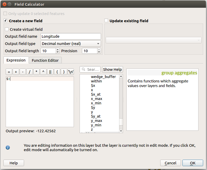
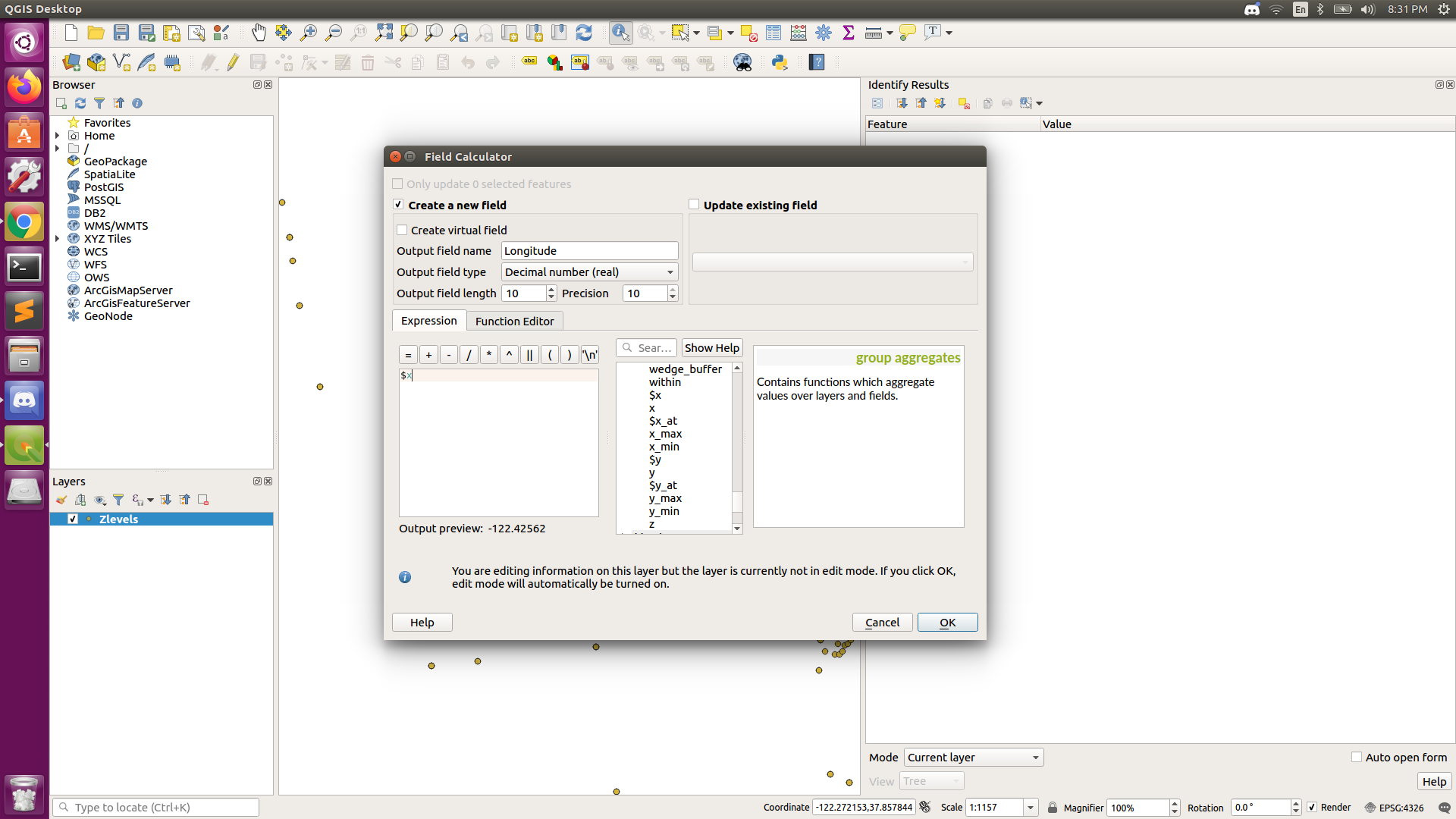
Create a new field and in the Expression field, type $x for longitude and $y for latitude.
Eg.
[ {.confluence-embedded-image
height=”250”}]{.confluence-embedded-file-wrapper
.confluence-embedded-manual-size}
{.confluence-embedded-image
height=”250”}]{.confluence-embedded-file-wrapper
.confluence-embedded-manual-size}
Watch out for the output field type. Change it to however type/percision you want.
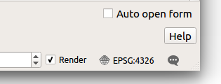
Make sure you have the right coordinate frame by checking the bottom right of QGIS. It should be WGS 84, EPSG:4326 (or whatever you want the coordinate frame to be).
[ {.confluence-embedded-image
height=”120”}]{.confluence-embedded-file-wrapper
.confluence-embedded-manual-size}
{.confluence-embedded-image
height=”120”}]{.confluence-embedded-file-wrapper
.confluence-embedded-manual-size}
\
This will take a few seconds so wait for it to finish.
\
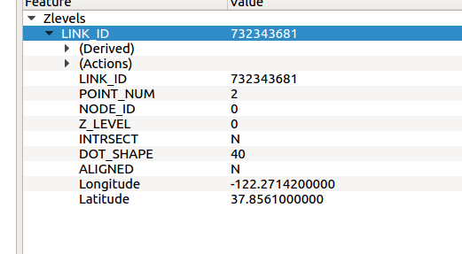
Now the long/lat data should've been added on to the layer.
It should look something like this:
[ {.confluence-embedded-image
height=”250”}]{.confluence-embedded-file-wrapper
.confluence-embedded-manual-size}
{.confluence-embedded-image
height=”250”}]{.confluence-embedded-file-wrapper
.confluence-embedded-manual-size}
\
To save these changes to the actual files, right click the layer you made the changes to and click Save Layer Edits.
This will take a LONG time. Do not force quit, just let it run. Do something else, go take a walk, go make coffee, or whatever.
This process will be SIGNIFICANTLY FASTER if you do it on a computer with better hardward (eg. the computer in the garage)
After it's finished, if you import this new file into the database, it will contain the new information.
\
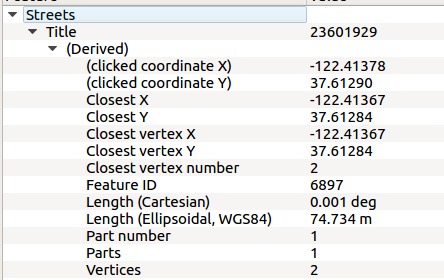
This method can work with most if not all the (Derived) information in QGIS. It can have other useful information such as length of a street, etc.
[ {.confluence-embedded-image
height=”250”}]{.confluence-embedded-file-wrapper
.confluence-embedded-manual-size}
{.confluence-embedded-image
height=”250”}]{.confluence-embedded-file-wrapper
.confluence-embedded-manual-size}
\
\
Attachments:
![]() image2020-1-28_20-27-50.png
(image/png)
image2020-1-28_20-27-50.png
(image/png)
![]() image2020-1-28_20-31-10.png
(image/png)
image2020-1-28_20-31-10.png
(image/png)
![]() image2020-1-28_20-31-29.png
(image/png)
image2020-1-28_20-31-29.png
(image/png)
![]() image2020-1-28_20-34-32.png
(image/png)
image2020-1-28_20-34-32.png
(image/png)
![]() image2020-1-28_20-46-41.png
(image/png)
image2020-1-28_20-46-41.png
(image/png)
![]() image2020-1-28_20-48-18.png
(image/png)\
image2020-1-28_20-48-18.png
(image/png)\
Document generated by Confluence on Dec 10, 2021 04:01